Southeast Turkey’s Diyarbakr, often spelt Diyarbakir, was formerly known as Amida. It is located on the Tigris River’s right bank. The name derives from the Arabic word for “district (diyar) of the Bakr people,” an Arab clan that ruled the city in the seventh century CE. According to legend, the present spelling of -bakr refers to the region’s rich copper deposits.
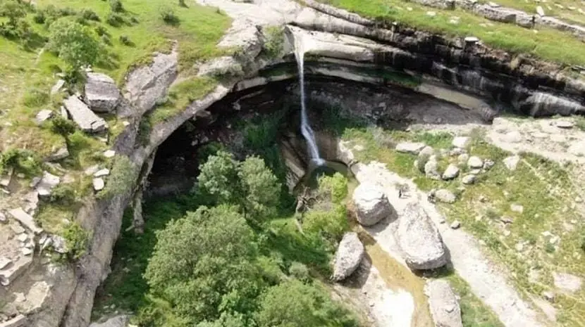
With its unexplored canyon, the waterfall in Diyarbakir’sKulp region that has been running for a thousand years is waiting to be discovered for outdoor recreation. The waterfall at Gomabelek’s tomb in the Baclar village of the Kulp area, which has been flowing for a thousand years, dazzles in particular in the spring with its pristine canyon.

The Diyarbakir waterfall, which eventually empties into the Tigris River after travelling roughly a kilometre, is awaiting consideration as a substitute path for outdoor activities. The Gomabelek hamlet is a portion of the Baclar village in the Kulp district, according to Prof. Dr. rfan Yldz, dean of the faculty of art and design at Dicle University, who spoke to a reporter for the hlas News Agency (UHA).
♦ 6 Days Turkey Tour – Best Turkey Tour Package
Prof. Dr. Yldz stated,
“A virgin canyon is an unexplored region. It is a waterfall that has been flowing for thousands of years. This water’s movement combines with the Shekran Stream. The start of ekran Stream is just one kilometre lower. Additionally, it enters the Tigris River from the Ekran River. This region is quite green and active, especially in the spring. The water level has now somewhat dropped. “There was much more water flowing 15 days ago.”
“This waterfall, which has been flowing for thousands of years, is the waterfall that flows from the highest place in the Diyarbakr region,”
Said Yldz, claiming that the location is a particularly good location for outdoor activities. It is a distinctive location for outdoor sports, particularly in the spring. You may access the waterfall canyon from the ekran Valley canyon. This trekking route is complete.

